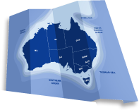
Have you ever seen a fish or marine creature that you are pretty sure doesn’t usually live along your stretch of the Western Australian coastline? Log your sighting on Redmap Australia, www.redmap.org.au, where citizen scientists collect information on our changing oceans.
Redmap asks the community to report sightings and photos of uncommon marine life at their local fishing, diving or swimming spots. Redmap WA is keen for unusual sightings of any marine life along the west coast – and not just fish, but also turtles, marine mammals, crabs, lobsters, seaweed, shellfish and prawns, to name a few. Photos are reviewed by a network of marine scientists around the country to verify the species identity and ensure high-quality data.
Redmap was first launched in Tasmania in December 2009 to track if marine species might be ‘moving house’ south along the Tasmanian coastline – or shifting their distribution – as we experience changes in the marine environment such warming oceans. In the first few years, Tasmanians logged hundreds of sightings including eastern rock lobster, yellowtail kingfish and white-ear, many of which were observed further south than their usual known territory.
Redmap Australia takes this concept national and aims to become a continental-scale monitoring program along Australia’s vast coastline to help track marine range shifts; but also to engage Australians with marine issues by collecting their own data.
Over in Western Australia, marine scientists gained some insights into how tropical species move southwards during a marine heat wave that occurred off the west coast in the summer of 2010/11. WA’s ocean temperatures were more than three degrees higher than usual during mid-summer over a very large area.
Dr Gary Jackson and colleagues at the WA Department of Fisheries started getting a wave of calls from the public reporting fish and shellfish kills between Shark Bay and Leeman, coral bleaching and unusual species sightings as far south as Albany on the south coast.
These reports included subtropical species such as black marlin (off Busselton), red bass and various damselfish and parrotfish (around Rottnest), Spanish mackerel, mahi mahi, whale sharks and manta rays (off Albany), all observed much further south than they’re usually found.
“It was obvious something very unusual was going on,” Dr Jackson said. A marine heat wave workshop was organized and attended by more than 80 marine scientists where the idea of becoming involved in the Redmap Australia project was discussed. More than 18 months later, and Dr Jackson started leading Redmap WA.
He’s confident the Redmap website and community sightings will help track any southern shifts along the state’s lengthy coastline.
“There are a lot of people out there on the water or under water or walking on beaches seeing things which would be of interest to us about how the ocean is changing and what the consequences are going to be for fish and fisheries in WA,” he said. The Department’s biosecurity scientists are also hoping to use Redmap to track movements of tropical marine pest species such as the Asian paddle crab and Asian green mussel.
Over time, and with many sightings, Redmap’s community data will help detect if marine species are setting up shop elsewhere or whether they are just one-off or seasonal visitors along parts of the WA coast.
This information will help to focus research and inform management about those species and regions that are experiencing more range shifts with a changing marine climate.
Redmap also engages people with their marine environment and with the issue of climate change. The website encourages members to share photos and anecdotes. It also has information and news on fishing, diving and the marine environment. Everyone can comment on the latest sightings and a smart phone application will be up and running in 2013 to make logging an unusual fish that much easier.
Redmap lets Australians collect, share, learn and comment on information about their local seas. And all whilst doing the things they love: diving, fishing and swimming!
Check out the marine biota that Redmap WA are tracking along the coast: Redmap WA species
*********************************************
Redmap is a large collaborative project lead by the Institute for Marine and Antarctic Studies (IMAS) at the University of Tasmania, and involving the University of Newscastle, James Cook University, the Government of South Australia Primary Industries and Regions SA (PIRSA), Museum Victoria, the Western Australia Department of Fisheries, the University of Adelaide and the South East Australia Program (SEAP).
The expansion of Redmap nationally was made possible with funding from an Australian Government Inspiring Australia grant, the Australian National Data Service (ANDS) and the Department of Agriculture, Fisheries and Forestry (DAFF). Redmap Tasmania started with funding from the Tasmanian Community Fund and Redmap Australia also receives support from Mures Tasmania and many fishing, diving and community groups around the country. And the website would not have been possible without the innovation and patience of Ionata Web Solutions and graphic designer Holly Webber.


